Qhapaq Ñan: the Inca road system
An extensive road system supporting communication and movement across the Andes.
- When
- Major expansion in the 15th–16th centuries
- Where
- Andean South America
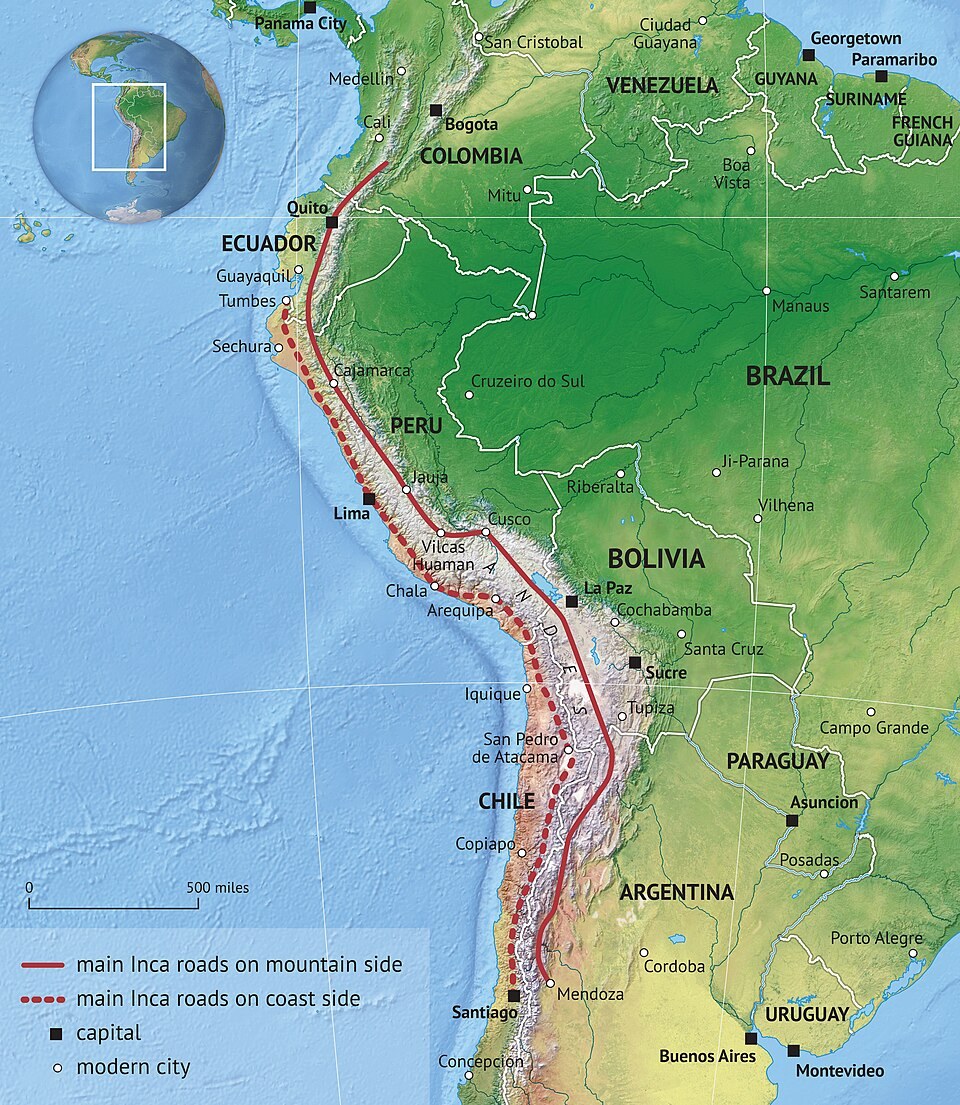
An extensive road system supporting communication and movement across the Andes. The Inca state incorporated regions separated by mountains, deserts and valleys. It expanded earlier routes into a connected network rather than inventing every road from nothing.
Background
An empire across difficult terrain
The Inca state incorporated regions separated by mountains, deserts and valleys. It expanded earlier routes into a connected network rather than inventing every road from nothing. Building and maintaining that network depended on labour obligations and local knowledge across diverse communities.[1]
What happened
- Inca expansion
Roads, bridges and waystations
Engineers adapted routes to steep terrain using stairs, drainage, retaining walls and suspension bridges. Waystations and storage facilities supported movement. Different sections served different needs, so the network cannot be understood only as a modern highway with one uniform design.[1]
- Imperial administration
Messages and supplies move
Relay messengers carried information, while armies, officials and goods travelled through the system. Access and use reflected political hierarchy. The same infrastructure that connected communities also supported state control, resource mobilisation and the movement of populations.[1]
Impact & evidence
More than a length measurement
Estimates of total network length vary according to which routes are included. Its significance lies in the coordination of engineering, labour and supplies across a continental landscape. Surviving bridges and paths also preserve knowledge held by communities, not only monuments left by rulers.[2]
Aftermath & legacy
Routes that outlasted the empire
Colonial authorities reused parts of the system, and many routes remained locally important. UNESCO recognition spans several modern countries because the network predates their borders. Conservation requires attending to living users and maintenance traditions as well as protecting archaeological remains.[1]
Sources & image credits (2)
Koen Adams · CC BY-SA 4.0 (source record). Resized for display. Image source ↗